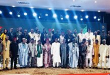
A professor of Applied and Environmental Geochemistry, Akinade Shadrach Olatunji, has called for the removal of the Nigerian Geological Survey Agency (NGSA) from the Ministry of Solid Minerals Development.
Olatunji, of the University of Ibadan, said the agency should be transformed into an autonomous institution under the Presidency to strengthen its contribution to national development.
He made the recommendation in a presentation titled “Roles of Geosciences in Attainment of the Sustainable Development Goals (SDGs),” at a Professional Training and Continuing Education programme organised by the Nigerian Mining and Geosciences Society.
He said the proposed restructuring would enable geological information to become more directly integrated into government planning, industrial regulation and economic policymaking.

According to him, geological, hydrogeological and geospatial datasets should be treated as critical public infrastructure because of their importance to national development.
He also recommended that a minimum of 50 per cent of the Natural Resources Development Fund be allocated to acquiring geoscientific data across areas where such information was central to development.
The professor further proposed the establishment of standalone Offices of Geological Services in all states of the federation, including the Federal Capital Territory.
He said such offices would serve as centres for providing state-level geological information needed to support SDG implementation.
Olatunji said the proposed institutional reforms were necessary because sustainable development could not be achieved by economic policies and social interventions alone.
He argued that development ultimately depended on the physical systems of the Earth, including the availability and condition of water, soil, minerals and land.
Geoscience and development
The don said geoscience had a much broader role in development than mineral exploration, covering water security, agriculture, infrastructure, energy, environmental protection and climate resilience.
He said geological knowledge provided the scientific basis for understanding, measuring and managing physical systems required for human wellbeing and economic development.
According to him, the SDGs were directly or indirectly dependent on geoscientific knowledge, particularly those relating to poverty, hunger, health, clean water, energy, sustainable cities, responsible consumption and climate action.
He said this was particularly relevant to Nigeria, where rapid urbanisation, infrastructure deficits, environmental degradation and water insecurity required reliable geological information.
“Geoscience has a critical role to play in the attainment of the Sustainable Development Goals,” Olatunji said.
He said geoscience could help address basic human needs, power economic growth and protect the planet.
Water security
Olatunji identified water security as one area where geoscience could have an immediate development impact.
He said groundwater constituted a major geological resource and that understanding aquifer systems was essential for developing reliable water supplies, particularly in drought-prone regions.
He said geological surveys could reveal the architecture of aquifers and help identify dependable groundwater sources.
Hydrogeochemistry, he added, could be used to trace the movement of contaminants from industrial and agricultural activities through subsurface water systems.
He also stressed the importance of determining groundwater recharge rates and establishing sustainable abstraction limits.
Without such information, he warned, excessive groundwater extraction could lead to aquifer depletion and, in some areas, land subsidence.
Olatunji said investments in groundwater mapping and monitoring should therefore form part of climate-resilient water management.
Agriculture and food security
The professor also linked geoscience to agricultural productivity and rural development.
He identified soil mapping, hydrogeology and geochemistry as important tools for determining soil characteristics, fertility and land suitability.
He said geoscientific assessments could support better agricultural planning and crop production by identifying suitable areas for particular agricultural activities.
He also pointed to the use of Landsat and Digital Earth Africa in predicting crop performance, assessing soil fertility and monitoring desertification.
The technology, he said, could support applications relevant to northern Nigeria, where desertification and land degradation remain major concerns.
He said identifying naturally occurring toxic elements such as arsenic, lead, chromium and zinc in soil and water was another important application.
Early detection of such contaminants, according to him, could help prevent exposure associated with non-communicable diseases and declining livelihoods.
He said interventions such as sustainable access to groundwater, fertile land and safe small-scale mining could strengthen rural communities and reduce vulnerability.
Infrastructure and urban development
Olatunji said geoscience was equally important to infrastructure development, particularly as Nigerian cities continued to expand.
He said geotechnical investigations were necessary to determine soil strength and rock stability before major construction projects were undertaken.
Such assessments, he said, could reduce the risks of building collapse and infrastructure failure.
He added that urban geology provided information required for underground development, including metro systems and deep basements.
Geological and geotechnical mapping could also identify areas vulnerable to erosion and other forms of land instability.
For coastal cities such as Lagos and Port Harcourt, he said groundwater studies could help planners understand waterlogging and foundation-related risks.
He argued that integrating geoscientific information into city planning would allow authorities to identify hazards before infrastructure was constructed.
Energy transition
The don said geoscience would also be critical to Nigeria’s transition towards cleaner energy.
He explained that renewable-energy facilities required stable geological foundations and detailed knowledge of subsurface conditions.
Wind turbines, hydropower dams and other major installations, he said, must be built on ground capable of supporting their long-term structural demands.
He also identified geothermal investigations as important for determining potential sites for solar and wind infrastructure and other renewable-energy projects.
According to him, the transition to clean energy would create additional demand for critical minerals such as lithium, copper, rare earth elements and cobalt.
These minerals are essential components of batteries, renewable-energy technologies and other clean-energy infrastructure.
He said geoscience therefore had a dual role in the energy transition: identifying mineral resources required for new technologies and ensuring that the infrastructure supporting renewable energy was safely located and constructed.
Climate and disaster risks
Olatunji said geoscience could help Nigeria move from reactive disaster management towards predictive risk reduction.
He said geological mapping, geophysical investigations and monitoring systems could help identify areas vulnerable to floods, landslides, subsidence and other natural hazards.
He said floodplain mapping, slope analysis and hazard monitoring could help communities and planners understand where risks were concentrated.
Such information, he added, could support safer infrastructure planning and emergency preparedness.
The professor also linked geoscience to climate-change research, saying geological records and sediment layers could provide evidence about past environmental and climatic conditions.
He said understanding historical climate patterns could help researchers improve climate models and prepare for future changes.
Protecting oceans and land
Olatunji said geoscience also had a role in protecting marine and terrestrial ecosystems.
For SDG 14, which concerns life below water, he said marine geology, groundwater studies and bathymetric mapping could help establish protected marine areas and support offshore infrastructure planning.
Hydrogeological investigations could also trace pollutants from agricultural areas through coastal groundwater systems into marine environments.
For land protection, he said remote sensing could monitor land-cover changes and desertification, while geochemical remediation could help restore contaminated mining areas.
He said geological and environmental techniques could also support the restoration of degraded land and reduce the environmental effects of mining.
Circular economy and waste
The professor said geoscientific information could support responsible consumption and production by improving the mapping and management of mineral resources.
He said better mapping of mineral deposits could reduce the risks associated with excessive exploitation and promote more sustainable extraction.
He also identified resource tracking and geospatial mapping as tools that could help transform waste from an environmental liability into an additional resource.
According to him, such approaches could create opportunities for reuse while reducing pressure on virgin mineral deposits.
Call for stronger data infrastructure
Olatunji called for stronger investment in geological information systems, including centralised pollution databases, spatial intelligence centres and comprehensive geological datasets.
He said Nigeria needed a national system in which scientific information was not merely collected for academic purposes but actively incorporated into government planning, industrial regulation and economic policy.
He also advocated stronger university geoscience programmes, increased support for environmental research and expansion of the professional workforce.
He particularly identified hydrogeology and geochemistry as areas requiring greater investment because of their importance to water security and environmental management.
The professor said building scientific capacity was essential if Nigeria was to effectively translate its natural-resource potential into sustainable development.
From reactive to predictive planning
Olatunji said the strongest message from the geoscience community should be a shift from reacting to problems to anticipating them.
He said governments could use scientific information to identify risks, assess opportunities and make evidence-based decisions before development problems became costly crises.
He called for geoscience to be embedded at the beginning of policy and planning processes rather than treated as an afterthought.
“Geoscience should no longer be viewed simply as the science of rocks and minerals,” he said.
According to him, its application extends from the food consumed by communities and the water they drink to the roads, buildings, cities and energy systems that sustain modern economies.
He said Nigeria’s pursuit of sustainable development therefore required stronger investment in geological information, scientific capacity, institutional coordination and geoscience-based policymaking.
He expressed confidence that better use of geoscientific knowledge could help the country diversify its economy, expand its mining sector, improve infrastructure, secure water supplies, respond to climate change and protect the environment.